Five Years In: On Planning, Power, and the Everyday City in Qatar

Most blog posts I’ve written here have had a target: to tackle urban woes and their impacts in Qatar and the region. But this time, I want to write something more reflective, what it feels like to be a practicing planner five years in. How I see the field today, what planning praxis looks like in Qatar, and what I think our national trajectory is shaping up to be.

Urbanism is a fascinating topic. I may be biased as a city planner, but I’ve always found it telling how everyone has an opinion on the built form. We all live inside the city, move through it, depend on it, so we all have a stake in how it is designed, managed, regulated, and experienced. The way we build and run our cities shapes the way we live our lives. It’s partly why some of the most influential voices in planning didn’t come from planning departments at all: Jane Jacobs (journalist and activist), Lewis Mumford (historian and cultural critic), Henri Lefebvre (philosopher and sociologist), and many others.

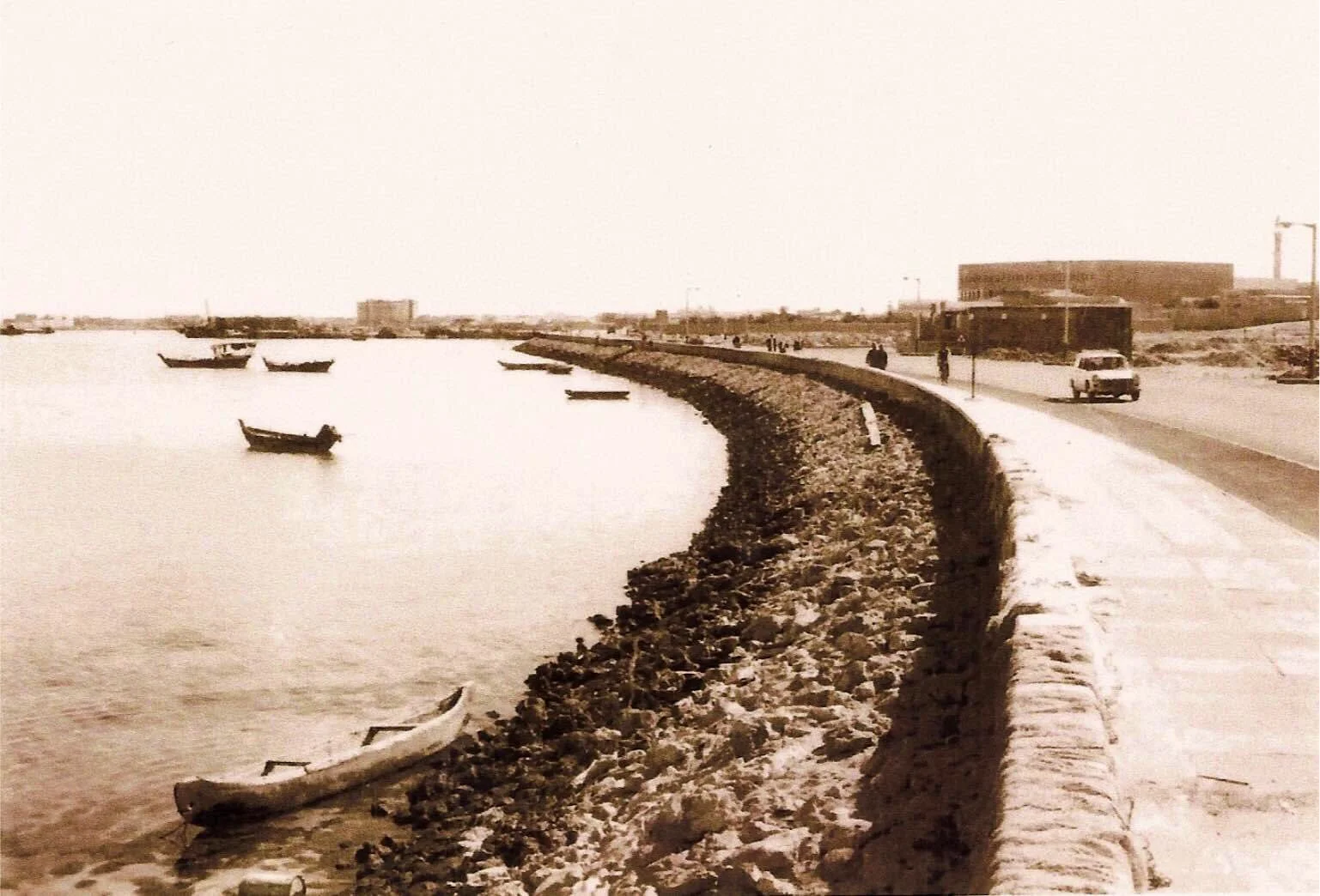
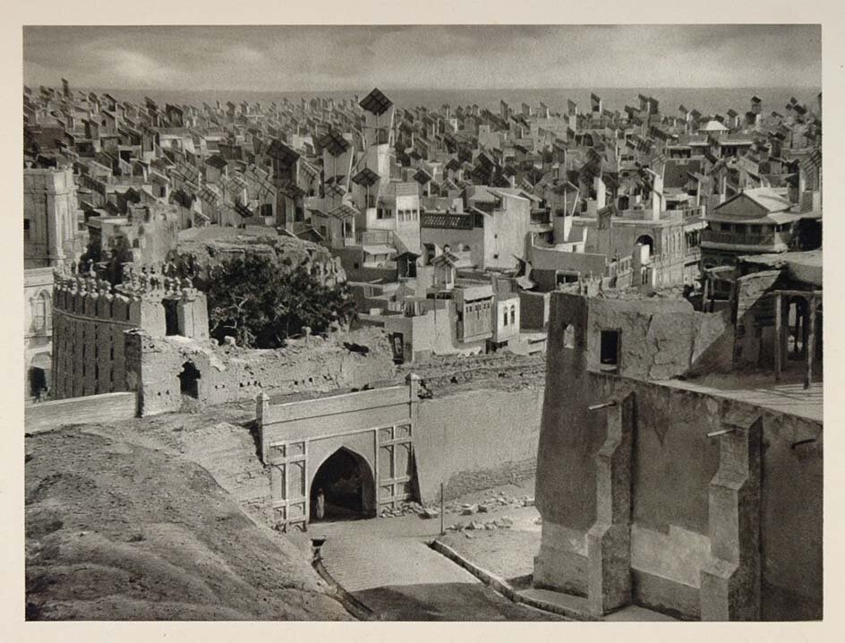
Doha Corniche in the Late 60s. (Source: @atiqalsulaiti on X.com)

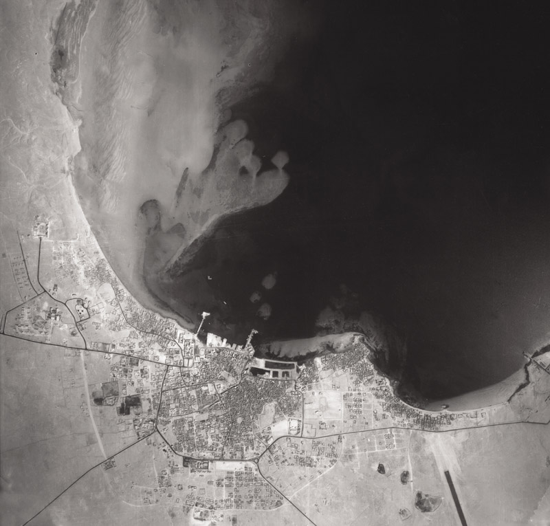
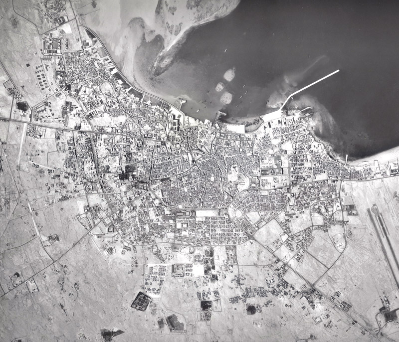
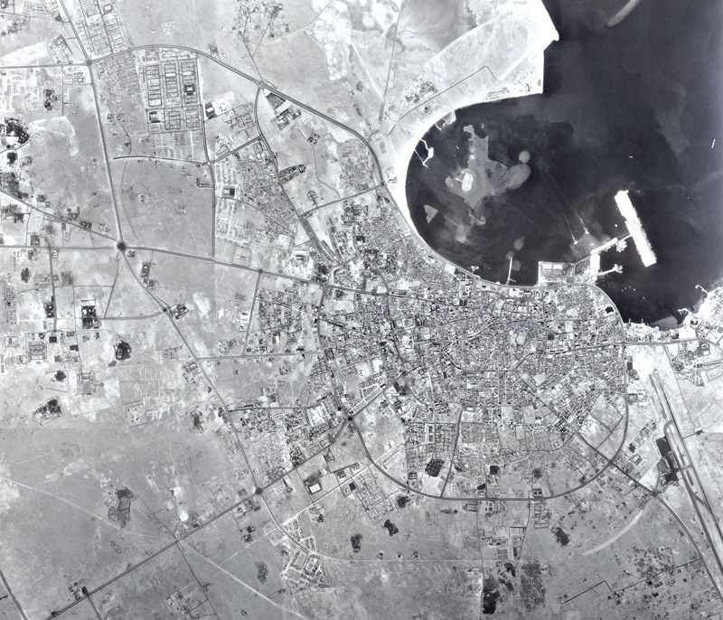
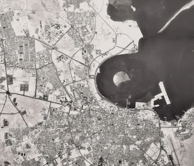
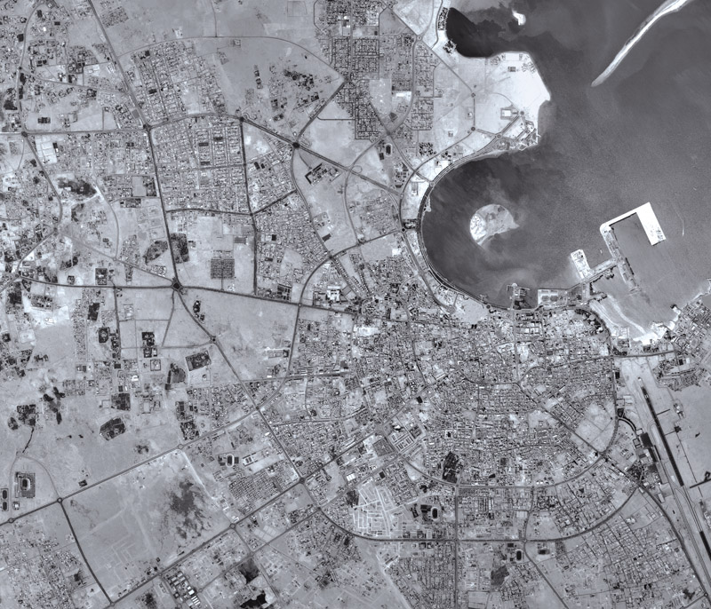
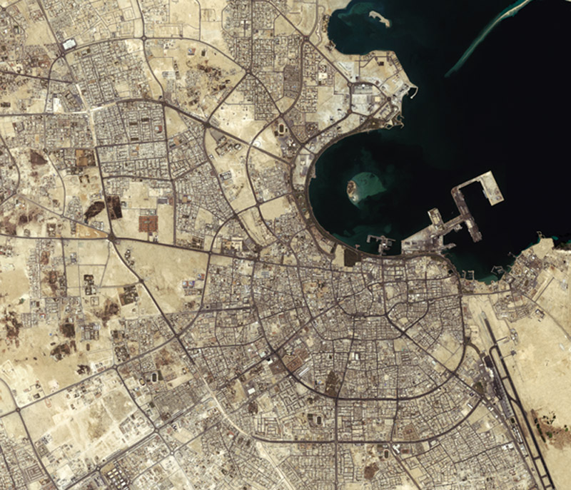
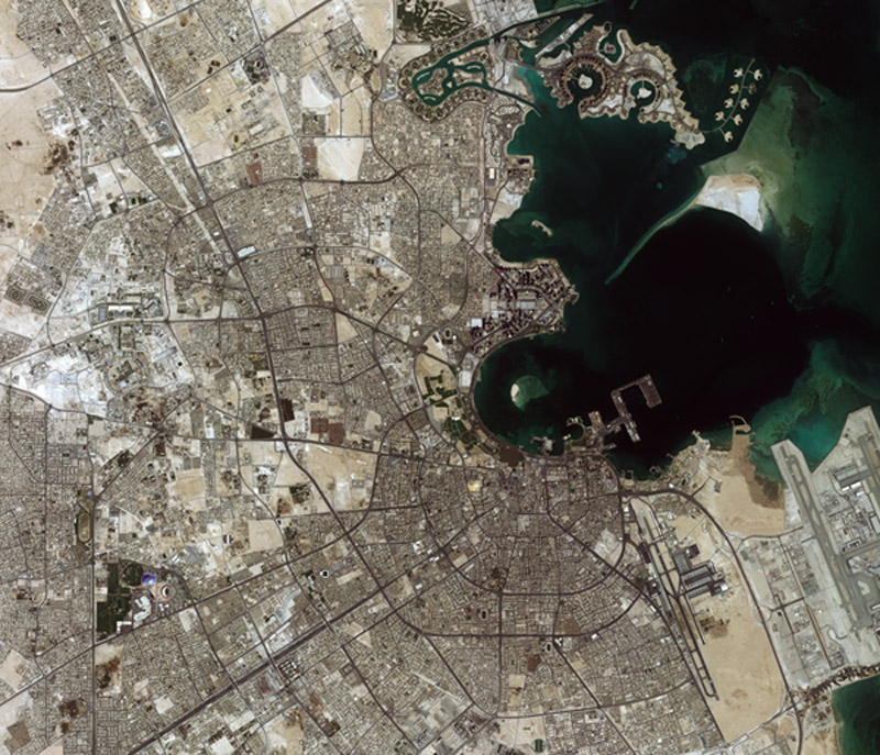
In Qatar, urban governance and planning is not a new experiment, it’s an old praxis. The State has long relied on global firms to shape Doha at different levels of planning. In 1971, a team from Llewelyn-Davies Weeks Forestier-Walker and Bor was invited to advise on the city, and they were formally contracted the following year. It was through their recommendations that an Urban Planning Department under the Ministry of Municipality was established in 1973. At a higher level, the Office of His Highness the Emir was also deeply involved in shaping the city directly, overseeing major projects, chief among them the New District of Doha (what we now know as West Bay/Al Dafna), with William L. Pereira & Associates responsible for developing and actualizing that plan. Later, in the 1980s, the Ministry would contract firms like Shankland Cox and Dar Al-Handasah to develop detailed plans for Doha’s redevelopment.

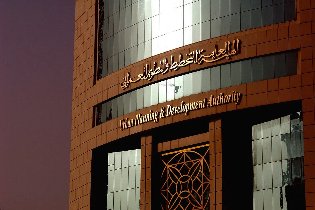
Urban Planing and Development Authority Tower, Doha, Qatar (Source: lookphotos / Stumpe, Jürgen)

Institutionally, the shape of planning governance has also shifted over time. In 2004, HH Sheikh Tamim bin Hamad Al-Thani (then Deputy Emir) signed the law establishing the Urban Planning & Development Authority. It remained an independent authority until 2014, when it was merged into the Ministry of Municipality to become the Ministry of Municipality & Urban Planning. Today, the sector remains under the Ministry of Municipality, especially after the separation of the Ministry of Environment.

At the same time, planning education in the country has noticeably withdrawn. The program is no longer offered at the undergraduate level, and urban planning has largely become a master’s track limited to those coming from engineering and architecture backgrounds. Scholarships dedicated to urban planning are practically non-existent, with the discipline often absorbed under a broader umbrella of “policy and planning” rather than treated as a field in its own right.

This preamble gives context to what I feel at this stage of my career, planners in Qatar are not always given their due as a profession. And that’s deeply concerning, not only as someone working in the field, but as a Qatari who cares about what our cities are becoming.


So, what is a planner in Qatar today?

It’s a question I’ve found myself returning to, sometimes out of curiosity, and sometimes out of frustration. What is the planner in the Qatari context?

The Human Resources department tells me I’m a “policy analyst.” That the work we do isn’t technical in nature. That we operate within the confines of an office, behind a screen creating, adopting, and measuring KPIs on urban policies. Ministerial decisions, on the other hand, define the Urban Planning Department through a much broader mandate: the preparation of urban, structural, and general plans for cities, towns, rural communities, and villages; the preparation of detailed studies and projects for neighborhoods and communities; the development of planning criteria and land use regulations; and the monitoring of urban structure through field surveys.

On the ground, however, planning is often perceived as an extension of the building permit process. We process approvals for larger projects and mega-developments, and we update regulations when issues emerge during implementation. Among the general public, the Department is often understood as “the land authority”, the place where decisions about plots, zoning, and large-scale approvals are processed. Within this dynamic, I’ve often felt that the role and value of the practitioner is not well understood.

So, what is the role of the planner in Qatar today, to me

It is far deeper than a policy analyst confined to a desk. We are obligated to conduct site visits. We conduct studies. We create codes and regulations that engineers and architects are expected to design within. And yet, the planner is often not compensated as technical staff, neither through internal HR classification, nor through national frameworks and policies governing public service roles. The irony is difficult to ignore: we are asked to shape technical outcomes, but we are never treated as technical professionals. The planner is the quiet engineer of outcomes, accountable for the city’s failures, yet rarely credited for its successes. The planner is the state’s spatial conscience, balancing growth with identity, land value with equity, and urgency with responsibility. The planner is a technical professional designing the systems of land use, mobility, density, and regulation that determine how a nation lives.

So why is the value of the planner misunderstood?

Part of it is on us.

Planners everywhere have never been great at marketing our occupation. We like to imagine ourselves as silent soldiers: doing the work quietly, avoiding the spotlight, trusting that good planning will speak for itself. In the Qatari and Khaleeji context, that media shyness can be even more pronounced. But part of it is structural. The outputs most visible to the public are subdivisions, zoning decisions, and building regulations. If that is all people see, then it is no surprise that planners are perceived as custodians of land and gatekeepers of approvals. And because much of our interaction with decision-makers is also framed through approvals and regulation updates, the image often remains the same even at higher levels.

How often have planners presented detailed neighborhood strategies to the public? How often have we spotlighted the work of the landscape architects, urban designers, and planners shaping new residential districts, and asked them to explain the design philosophy behind street networks, public space, shade, walkability, and identity? When we don’t narrate our own work, others will narrate it for us, and they will usually reduce it to whatever is most visible: permits and plots.

And then there is the deeper issue: the gap in planning education.

The gap in planning education has cost the State deeply, both on a technical level and strategic level. The absence of national planners rooted in local customs and traditions creates a major gap in our ability to translate international best practice into the Qatari context. Beyond that, many decision-makers lack the technical depth needed to interrogate recommendations: to test whether a proposed planning direction makes sense, and whether the evidence behind it is reliable. This has produced an overreliance on imported planning knowledge and practitioners to fill the technical gap. But even when that “band-aid” holds, the higher-level gap remains: a shortage of local planning leadership capable of steering the country’s urban trajectory with confidence, context, and accountability.


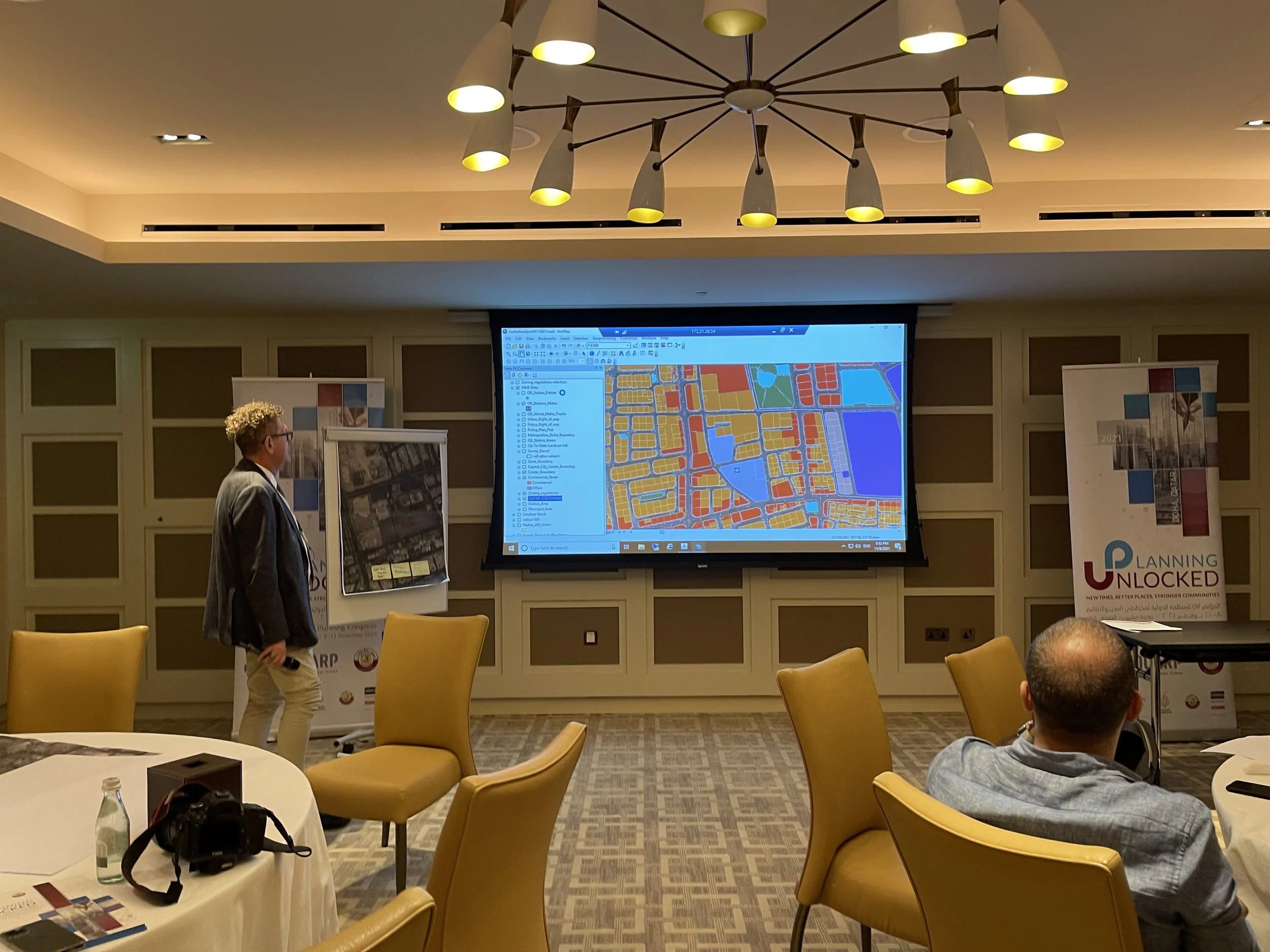
Five years in, I don’t feel like I have all the answers but I do feel like I’ve earned a few convictions. They came from site visits in the heat, from meetings that stretched longer than they should have, from regulations that looked simple on paper and complicated in real life, and from watching how small decisions echo across an entire neighborhood. Here are five lessons I’ve learned, and lessons passed down to me from my seniors at the department when I first started:


Lesson 1: Be inquisitive, beyond curiosity!

(Source: pexels / Leeloo The First)

And by that I mean ask questions relentlessly, and don’t stop at what the process is.  Ask why it exists in the first place. Why does a workflow function the way it does? Why were certain codes written this way? Under what conditions were they designed, and do those conditions still exist today? Why did certain projects receive special approvals, and what precedent did that set? That kind of inquiry is how you move from simply enforcing inherited rules to actually improving them. If you want to build better regulations, you first have to understand the logic and the history behind the ones you’re enforcing.


Lesson 2: Do not give up a single square inch of park space.

We are often too quick to surrender park space for two reasons: it produces no immediate economic return, and in Qatar it costs real money to build and maintain. But parks are not “leftover land.” They are public infrastructure. They’re where children learn the city. Where neighbors become a community. Where a district gets its breathing room. And in a hot climate, shade, trees, and well-designed public space aren’t aesthetic luxuries, they’re health and resilience measures that reduce heat stress and make everyday walking possible. A good park also pays back quietly over time: it supports mental wellbeing, offers free recreation across income levels, strengthens neighborhood identity, and creates places to gather that aren’t gated, commercial, or exclusive.


Lesson 3: Build your network within the bureaucracy.

Planning is intersectional by nature. Every serious planning decision touches multiple sectors: transport, environment, heritage, utilities, housing, public health, tourism, and more. To understand projects properly, you need data and perspective from all sides, and you will not always have direct access to either. A strong network across entities (and across departments within your own) is not a “nice-to-have.” It is part of the job. Know the direction different institutions are taking. Understand how they see their own mandates, projects, and constraints. Learn the language of the heritage and museums sector, the environmental sector, infrastructure agencies, and others and look for ways to connect them. Synergy isn’t accidental; it has to be built.


Lesson 4: Stay engaged!

Keep learning. Stay current with planning literature. Write articles, reflections, even short notes that force you to clarify your thinking. Give talks. Attend public forums (or whatever the municipal equivalent is). Go to conferences. Spend time with academics. Travel to other cities and observe with intention. It is dangerously easy, in government work, to become a “regulation bot”, someone who enforces rules inherited from another era without questioning whether they still serve the city. Staying engaged is how you remain a professional, not just a processor.


And finally, the most important lesson I’ve learned…

Lesson 5: Do not compromise on best practice!

I’ve seen planners and designers, time and time again, give up on arguing for best practice, not because they don’t believe in it, but because the process is exhausting. And it is exhausting. But as a trained planner, you have a responsibility to uphold a professional standard. Some decisions will always be political. That’s reality. But it is not your role to predict what decision-makers will choose and then dilute your technical recommendation in advance. Write the recommendation as it should be, grounded in sound planning principles and evidence. If leadership chooses a different path for political reasons, let that be a decision made on its own terms, with its own accountability. Your role then becomes to mitigate negative consequences as much as possible, without rewriting “best practice” into something unrecognizable.


So where does that leave us?

If we keep treating planning as a back-office function, something adjacent to permits and paperwork, we will keep getting cities that behave like paperwork: efficient on paper, expensive in reality, and emotionally thin. The profession cannot mature if it is unclear, undervalued, and under-trained. And the country cannot rely forever on imported expertise to supply judgment it has not cultivated locally.

We need to invest again in planning education, professional recognition, and public literacy because these are not nice-to-haves; they are the foundations of urban quality of life.

I don’t write this as someone who has figured it out, I write it as someone who has finally understood what the job actually asks of you. In Qatar, the planner lives between definitions: between what the org chart says we are, what the public thinks we do, and what the city truly demands from us. And that gap matters, because cities don’t absorb ambiguity politely; they absorb it through heat, traffic, isolation, fragmented neighborhoods, and public spaces that never become public.

But I’m not pessimistic. I’ve seen how much can change when a planner is empowered to ask “why,” when public space is treated as non-negotiable infrastructure, when networks across government actually function, when professionals stay engaged with knowledge rather than only process, and when best practice is defended with a straight back, even if the final decision goes elsewhere. These lessons are small on paper, but they accumulate. They shape the quality of neighborhoods. They shape trust in institutions. They shape whether our cities feel like places we belong to, rather than projects we pass through.

If planning education has withdrawn, then those of us practicing today carry a heavier responsibility: to be both practitioners and translators, both technicians and advocates, both public servants and students of the city.

My hope is that, as a country, we start treating planning not as paperwork and approvals, but as nation-building, expressed through streets, parks, codes, and the everyday life they make possible. And if I’ve learned anything in these five years, it’s this: the city will outlive our meetings, our memos, and our job titles. What remains is what we chose to protect, and what we chose to compromise.

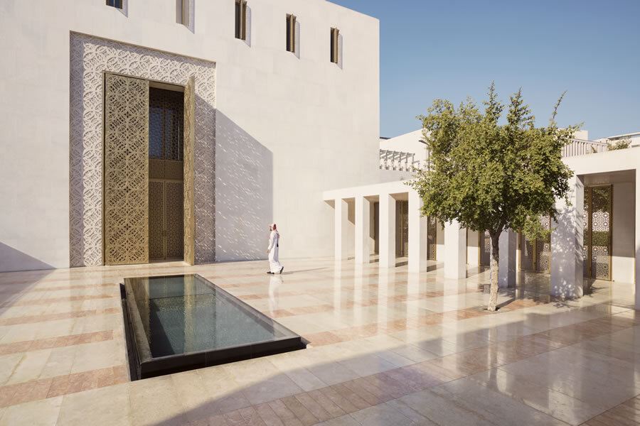
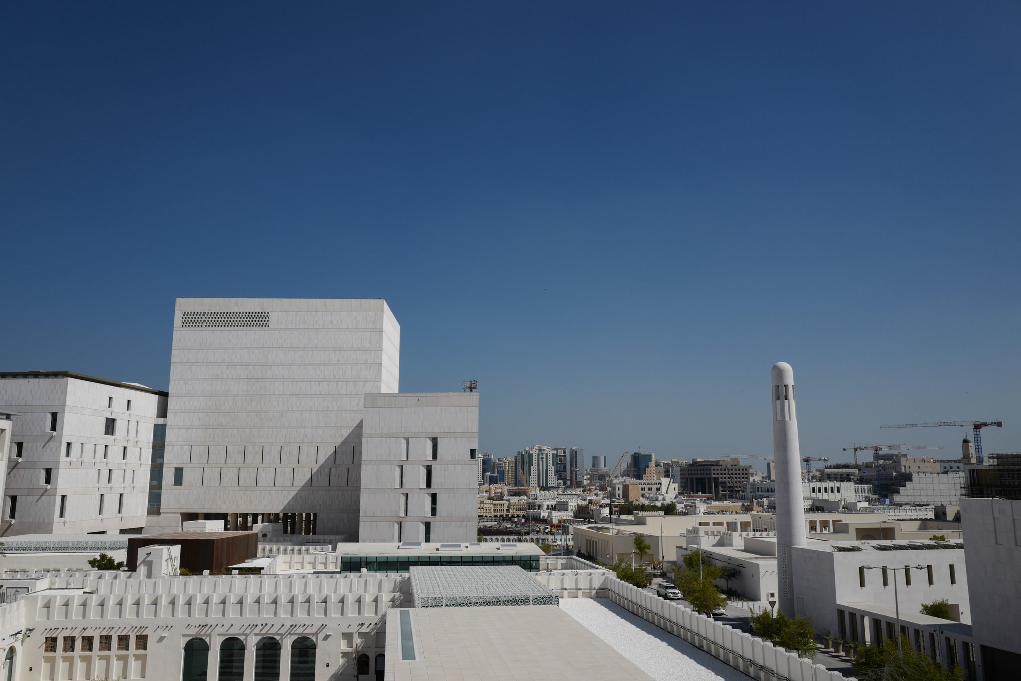
The Amiri Diwan, Doha, Qatar. (Source: Myself)

Heritage, Citizen Planning, and Fostering Belonging

Photo taken near Qasr Al-Hokm. (Myself, 2025)

The International Society of City and Regional Planners' 61st World Planning Congress hosted in Riyadh, Saudi Arabia, last week calls on "Cities & Regions in Action: Planning Pathways to Resilience and Quality of Life" to analyze, discuss, and search for better pathways for urban and regional planning aiming at improving the quality of life of citizens.

It is in this light that I'd like to share a personal story from last year - on an experience I've had, 200 km north west of the host city: Riyadh.

Most of my visits to Riyadh have only been for a few days, usually to attend a workshop, conference, meeting, or an event. On my last trip, I've decided to experience Riyadh in a completely new light - not as a city of the future, but as a city of the past, rooted in its culture, heritage, and history.

I've long been interested in heritage sites within the built form. The adaptive reuse of buildings, its activation, management, and the way that it forms the city's identity. It is for that reason, I decided to explore a village rich in history and culture, with roots to my own heritage.


Early in the morning, on a complete whim, I was exploring the area surrounding Riyadh via Google Earth, and my eyes lay on a familiar name: Ushaiqer. I had heard of Ushaiqer from family members as the origin point of our family, 200 odd years ago or so. Without doing any research on what it looks like, whether or not it had been preserved, and how easy it is to get there, I grabbed my car keys and made the drive.

I arrived in Ushaiqer around noon, right after Duhur prayer. As I was walking down its alleys, I was stunned by just how peaceful, quiet, and stunning its buildings are, and quickly started taking photos with my phone. Given my arrival time, it was no surprise that the village was empty and quiet, but from a distance I hear the sound of laughter, and I hear a voice calling for me:

أووه، يالكشخة! تعال! اخوياي سواليفهم مثل وجيههم ما عاد ابيها. تعال اهنا ناخذ من عندك العلوم الطيبة.

If I were to translate it, it would be something along the lines of: “Hey, style icon! Over here! I’d done with my boys and their dead chat, it’s getting unbearable. Slide over and give us the good stuff, you look like you got some good conversation!”

Dar Al-Mshraq [Al-Salem House], Ushaiqer Heritage Village. (Myself, 2025)

I walk over to his majlis and I’m astounded just by how beautiful it is. Thick mud walls the color of date syrup, edged in bright white plaster that catches the light. The ground under my feet is uneven stone, worn smooth in places, as if generations have paced the same path.

Up close, the details start to speak: a small wooden window set deep into the wall, a heavy door tucked into shadow, and above it a rounded corner tower that leans over the courtyard like a lookout. The parapet is crowned with white pointed teeth, Najdi-style crenellations, marching along the roofline in a clean rhythm. Under the overhang, rough wooden beams poke out, dark against the clay, and a few hanging lamps sit quietly in the shade, waiting for evening.

Inside, the majlis feels warm, like the embrace of an old friend, even though everyone here is a stranger. Low timber beams and packed-earth ceilings sit overhead, lantern lights casting a soft glow across mud-plastered walls trimmed in crisp white patterns. Rugs cover the floor in bold reds and geometrics, cushions line the edges, and wall niches display brass dallahs and old keepsakes, giving the whole room a quiet, lived-in calm.

Fahad Al-Salem, Abu Abdulaziz, the host and owner of the home.

The owner of the home, Bu Abdulaziz, is an interesting, charismatic figure. One of those people who makes a place feel alive the moment he starts talking. He doesn’t just greet passersby; he gathers them in, eager to share the story of his house and the village around it. He asks my name, where I’m from, and as soon as I introduce myself, he smiles and says he can tell my family’s roots trace back to Ushaiqer. I confirm it, and in that instant the distance between “guest” and “family” seems to disappear.

From there, the day unfolds like I’m not visiting at all, like I’m returning to something I’d forgotten was mine. I spend hours with Bu Abdulaziz, his brother, his nephew, and his in-laws, moving through the village as they point out the buildings that matter: old homes, gathering spaces, corners with stories attached to them. They walk me through the village’s history with the ease of people who’ve lived it, not just memorized it.

They show me the farms, how the land still holds its rhythms, and talk about the residents’ role in keeping everything standing. What stays with me most is the pride in the details: how they rebuilt what time had worn down, how they preserved the character instead of replacing it, and how care for the village isn’t a project for them, it’s a responsibility, carried quietly, like looking after your own family home.

We spent the evening tucked between Ushaiqer’s dunes, the air cooling as the sun slipped away. Abu Abdulaziz filled the silence with old stories, then began reciting poetry, verses about family, history, and heritage, and the feeling of returning to where you began, as if every road eventually bends back to its origin.

What I witnessed in Ushaiqer wasn’t just “heritage preservation” in the institutional sense, it was a living form of planning, led by residents who understand the value of place because they’ve carried it in their daily lives. In a time when we often speak about resilience through infrastructure, policy, and technology, Ushaiqer reminded me that resilience is also social: it’s memory, stewardship, and the quiet pride that turns maintenance into meaning. Bu Abdulaziz and the people of the village weren’t simply restoring walls, they were restoring continuity, making sure the village remains legible to its children, and welcoming to those who arrive searching for something they can’t quite name.

Between the dunes of Ushaiqer (Myself, 2025).

This is where the idea of “citizen planners” becomes real. They may not write zoning codes or draft masterplans, but they shape the future through caretaking, storytelling, hosting, and rebuilding with sensitivity. They safeguard identity while keeping the village active, not frozen, proving that belonging is not manufactured through branding, but earned through relationships, ritual, and shared responsibility. The majlis becomes a planning room. The alley becomes a narrative archive. The farm becomes an ecosystem lesson. And the visitor, stranger, or descendant becomes part of the story the moment they’re welcomed in.

As we continue to discuss pathways to quality of life in our cities and regions, I keep returning to that evening in the dunes: poetry about family, history, and the pull of origins, spoken under an open sky. It made me reflect on how our planning practice can better honor people’s emotional geographies, not only where they live, but where they feel they belong. Perhaps the most enduring form of resilience is the one that makes a person say, even far from home:

I’ve returned.

The Villa in a Khaleeji Context: The Role of Regulations in Erasing Indigenous Building Practices

“A Qatari house in Al Dafna area” - Nayla Al-Naimi in The Morphology of Urban Qatar Homes

“A Qatari house in Al Dafna area” - Nayla Al-Naimi in The Morphology of Urban Qatar Homes

Megaprojects in the Khaleej, particularly in Qatar, focus on branding themselves with a ‘new architectural language’ that is uniquely Qatari, Khaleeji, Arabic, or Islamic. This is especially true with the urban revitalization project ‘Msheireb Downtown Doha’ where a new architectural language was one of its many pillars in creating a new identity for Doha based on ancient architectural practices. Other megaprojects in the city market themselves as showing a cultural flair as well, the architecture of the Al Bayt and Al Thumama Stadium, which are set to host the World Cup in 2022, were directly influenced by Qatari culture. Architects, designers, and government officials are keen on injecting cultural influences within the Qatari urban space whenever it is possible. However, the architecture of government-sponsored megaprojects only plays a small piece of the puzzle in the way architecture is experienced in the Qatari urban form. A quick look at a land-use map of Doha and its surrounding municipalities (or a satellite image for that matter) shows that the bulk majority of land use is predominantly low to low-medium density residential housing. This problem is not unique to Doha, the bulk majority of cities in the Khaleej are dominated by single-family houses and villas. The ‘villa’ is not native to the region, yet it dominates our cities. The word typically describes a large and luxurious country house, particularly in Continental Europe. Yet the villa has forced its way into our vernacular speech, as well as our cities. The injection of an architecturally foreign mode of living directly clashes with the direction that the government is steering towards. This begs a multitude of questions to be asked: How did we get here? What are the socio-cultural and environmental consequences of the villa in this context? Is there room to reappropriate the villa? And do zoning code and building regulations play a role in the way tastes are being shifted towards the villa?

16-12-13-Msheireb-1425.jpg

Msheireb Downtown Doha

The Msheireb Downtown Doha project prides itself on merging modern and traditional architectural styles in its neighborhoods, and set out to create a modern architectural style that is uniquely Qatari

Like most things in the Khaleeji urban landscape, much of the shift in our housing patterns owes itself to modernization policies set forth by the British protectorate, as well as newfound wealth from oil. Prior to the mid-20th century, courtyard houses were the preferred mode of living for the vast majority of natives. Traditional courtyard houses were built on two key elements: materials that were readily available and the maintenance of privacy in the home. Houses often had multiple entrances, one for guests and one for its tenants. Houses were designed insularly, open spaces and yards were in the center of the house. The dwelling itself acted as a barrier for the yard. Allowing its tenants to exercise their daily lives with relative ease. As practitioners of Islam, privacy is a critical need for family living. Ensuring that there are spaces where the women of the family are comfortable and do not have to worry about the male gaze was of vast importance to the communities of this region. Additionally, people relied on natural ventilation through vernacular architecture to cool down their houses and the sun for natural lighting. This meant that the orientation of the building itself was important, ensuring that certain built elements can capture wind to cool down houses, as well as maximizing the amount of appropriate sunlight that was needed.

“Traditional stone-built houses in Najada” - Daniel Eddisford in Traditional Domestic Architecture of Qatar

“Traditional stone-built houses in Najada” - Daniel Eddisford in Traditional Domestic Architecture of Qatar

The British presence in the region had a significant impact on the urban form, the lack of formally educated natives to work as technicians and specialists in the oil sector meant that many British and American engineers had to be recruited to the region. Housing built for foreign engineers were naturally modeled after housing units they were most familiar with: the villa. Additionally, building regulations at the time were heavily modeled after British standards, as a result, our regulations accommodate a certain urban form much better than the native urban form. For many residents, the old urban form became a visual reminder of poverty. It carried a great sense of misery and anguish. Particularly during a time where the pearl diving industry was hit hard by the Great Depression, Japanese artificial pearls, and a reduction in yield from pearl banks, the sole lifeblood of the regional economy could not provide basic sustenance for Khaleejis. Consequently, eyes were turned to the villa, as a new and modern way of living. One which symbolized wealth, prosperity, and ultimately status. The villa would become a showpiece. Western-design influences were a sign of sophistication, privilege, and class. The view towards traditional houses was less than pleasant, tied to poverty. Increasingly, natives left the urban core where traditional courtyard houses were and moved to the suburbs with newly built villas. The traditional urban core was torn down in some instances, put in its place are commercial apartment buildings to house a new foreign working class. In other instances, traditional houses were crumbling due to their old materials and poor maintenance. You’d be hard-pressed to find any courtyard houses in the average suburb of Doha.

The shift towards the villa created a shift in the cultural definition of privacy in the Khaleeji housing unit. A single-family villa enclosed by four walls with a front yard and a backyard. Our definition of privacy changed from a communitarian one to a personal one. The courtyard house had many layers of privacy that could be peeled back, the home was designed in such a way to have designated spaces for guests that would transition into a private spot. Conversely, the villa was completely private. It did not allow for any manner of flexibility, and once you step out of the confines of the walls of your house you enter the public realm. This means a guest entering your house occupies a space that was designed to be completely private, whereas the courtyard house can protect your personal privacy while creating a space that exists between the public and private realms. Additionally, the villa does not make good use of private open spaces. As opposed to traditional courtyard houses, the yard of a villa is regulated to either the front or back of the house. Meaning that ancillary buildings that may be occupied by ‘strangers’ limit who can and can’t use these open spaces and during which times of the day. This issue does not exist in the courtyard house. Courtyard houses were built in a way to cool down open spaces either through wind elements or casting shade onto the yard. It is not always that a villa will cast a shade onto your yard. Moreover, the management of space, electricity, and water tends to be very poor in a villa. Yet, despite both the environmental and the sociocultural consequences of this housing unit it continues to dominate our urban fabric. This raises a concern for urbanists such as myself, do our building regulations promote this type of housing unit, without giving room for architects and designers to accommodate these social needs? 

Looking at current regulations for R1 Zones in Doha, which is designated as low-density residential zones, the front setback for the average plot is set at 5 meters. The side setbacks are set at 1.5 meters without windows and 3 meters with windows and if the wall faces a street the side setback is also set at 3 meters. The back setback is also set at 3 meters. The build cover area is 60% and the floor to area ratio (FAR) is 1.65. I partnered up with Salman Al-Sulaiti, an old friend and a brilliant architect out of California Polytechnic State University to explore whether or not current building regulations allow courtyard houses to be built, and could it possibly explain the dominance of the ‘Villa’ in modern urban developments.

We adopt a ‘communitarian’ definition of privacy as within the context of local traditions and religious lifestyles of the Khaleej it is a critical step to understand the advantages courtyard homes have to regional living. Using a religious framework, we develop an accurate spatial definition of privacy. With this in mind, we define the range between the public and private realms through the level of comfort in which women can present themselves when choosing to wear a hijab or a niqab (face veil). In public spaces, where people are exposed to the foreign gaze, Muslim women will often choose to cover themselves by way of scarves and veils. The next layer we define is the semi-private spaces, which acts as a reception for guests. These spaces will often be a meeting point for female visitors and extended family members (excluding male in-laws). In these spaces, Muslim women do not have to uphold the expectations of covering themselves, but because of the accompaniment of guests, there is a certain expectation in presenting themselves. In private spaces; where you are only exposed to direct family members, there are no expectations for dress and they act as spaces where you can find absolute comfort.

Diagram courtesy of Salman Al-Sulaiti (2021).

Diagram courtesy of Salman Al-Sulaiti (2021).

Using this religious framework to apply a spatial definition of private and public realms, we analyze the differences between the different modes of living through the following renders and illustrations. We define the ‘public’ zone as any area which exposes the tenants to the foreign gaze. The ‘semi-private’ are zones within the house that are designed with guests in mind. While the ‘private’ zones are exclusive to the tenants of the house. We work with a 600 square meter plot in a typical R1 Zone you would find in Doha, outlined below. We hypothesize that the villa’s dominance in the Qatari urban landscape may not entirely be due to preference, but due to regulations. Setbacks in R1 zones require you to keep open spaces in front of the house, this forces developers to build into the villa-style to maximize the build area, otherwise, you waste space. In the first example, Salman provides us with a typical villa and mapping out the private, semi-private, and public spaces.

Model of a typical Qatari villa, Salman Al-Sulaiti (2021).

Model of a typical Qatari villa, Salman Al-Sulaiti (2021).

Diagram of spatial privacy in the villa, Salman Al-Sulaiti (2021).

Diagram of spatial privacy in the villa, Salman Al-Sulaiti (2021).

We found that the villa lacks open spaces that are either semi-private or private, meaning that not all tenants of the house would be able to exercise absolute freedom within open spaces. This mode of living is not at all suitable for the cultural needs of the Qatari house. The front setback of the house forces developers and homeowners to take advantage of the front yard and make it into an open space to maximize their build area. We then tried to develop a courtyard house within the framework of existing regulations and setbacks.

A modern concept of the Qatari courtyard house under current regulations, Salman Al-Sulaiti (2021).

A modern concept of the Qatari courtyard house under current regulations, Salman Al-Sulaiti (2021).

Spatial privacy of the Courtyard house under current regulations, Salman Al-Sulaiti (2021).

Spatial privacy of the Courtyard house under current regulations, Salman Al-Sulaiti (2021).

As illustrated by Salman, current regulations do not accommodate the courtyard house. While the total built area and the open space area are equal, you get a sliver of private and semi-private open spaces, at 31.5 and 46.5 meters squared respectively. Theoretically, you could increase the size of the courtyard, but it would come at the cost of your built area. This front setback makes it incredibly inefficient and impractical to build into the courtyard house style. Under proposed setbacks at the street level, while maintaining total build area. Not only do we allow the courtyard house to maximize the built area, but it also allows for private open spaces to flourish.

A modern concept of the Qatari courtyard house with proposed setbacks, Salman Al-Sulaiti (2021).

A modern concept of the Qatari courtyard house with proposed setbacks, Salman Al-Sulaiti (2021).

Spatial privacy of the Courtyard house with proposed setbacks, Salman Al-Sulaiti (2021).

Spatial privacy of the Courtyard house with proposed setbacks, Salman Al-Sulaiti (2021).

Essentially, current regulations force homeowners and architects to build in the style of the villa. Regardless of whether or not it meets the cultural needs of our society. Designers and homeowners should have a choice in what style of living they want to adopt.

The zoning regulations in the Qatar National Master Plan outlines the idea that courtyard houses should have a separate setback, but looking at the existing framework and regulations that we build on, it has yet to be adopted. Through this exercise and experiment, I and Salman hope to illustrate how these regulations do not meet the cultural demands of Qatari society. Both the state and the people are very keen on preserving and in some cases, reviving the cultural traditions of our people. Whether it is through awareness of folkloric traditions, the sea shanties of pearl divers and merchants, and most certainly within the field of architecture. However, we should think beyond just preserving old buildings and architecture, and start thinking about reviving practices that allow us to live the way we want to. Through these diagrams and illustrations, we make the argument that it simply cannot be done now. If the concern that changing setback regulations would alter the environment and ruin the quiet suburban feel, we must remember that Khaleeji architecture, natively has always been low-density. Very rarely have buildings ever exceeded three stories, two-story houses were a rare sight too. Our indigenous urban environments have always had a certain quiet suburban field to them, and the form residences took best suited the needs of the people. Famed Qatari architect Ibrahim Jaidah writes in the opening pages of ‘The History of Qatari Architecture’:

Architecture is not only related to buildings but represents the identity of peoples and civilizations... The qualities and features of architecture in the Islamic world set it apart from all other architecture Its most outstanding feature is the focus on interior spaces as opposed to on the outside or the facade.
— Ibrahim Jaidah, Malika Bourennane in The History of Qatari Architecture (p. 11)

We are undeniably a Muslim nation, our national and cultural identity is integrally linked to our faith. Yet, our residences and architectural modes do not at all represent this identity, nor does it allow for our practices to flourish. The question asks itself then: why do we continue to embrace it? We have a responsibility, as designers, planners, and policymakers to consider these questions and tell ourselves: the choices that we make play an active role in what cultural practices die, and how foreign ones (which do not suit the cultural or physical environment) come to replace them. There is no denying that there are people out there who enjoy the facade and the lifestyle provided by the villa, but is that cost worth killing our own cultural identity over, and is it worth stopping a possible revival? Especially when laxing these regulations allows individuals to make these choices for themselves.

This article was written in collaboration with Qatari architect, Salman Al-Sulaiti. Please support him and follow him on Instagram: @sgalsulaiti

Bottom-Up Approaches in Governance & Dynamic Building Regulations in the Arab-Islamic Urban

Aerial photograph of Baghdad Iraq. Taken between 1920-1934. (Granger Historical Picture Archive)

Aerial photograph of Baghdad Iraq. Taken between 1920-1934. (Granger Historical Picture Archive)

The concept of Islamic urbanism and architecture has been extensively talked about in academia and print media. It continues to be a point of fascination to many: the geometric spaces and patterns, the meticulous ornamentations which decorate the buildings, the grand mosques, and luxurious castles, but what is often neglected are the principles of which Islamic urbanism is built upon: sharia, and the traditional bottom-up approach to urban governance in the Arab-Islamic urban context. Researchers on the old traditional cities of the Middle East and North Africa note that they are organic and unplanned, while this is certainly true, the framework of urban governance in Islam was very conventionally different from the planning oriented approach in the West, which came to dominate the field of city planning and urban design. When talking about traditional urban spaces across the Islamic world, the same orientalist tropes are often regurgitated without much critical thinking: they are chaotic and hectic because of their organic and unplanned nature, however, when looking at context clues in the Islamic urban and we begin to understand that the opposite is very much true.

Oleg Grabar opens his article on the Growth and Culture of Urban Islam with an inscription on a mosque from the eleventh century:

This mosque was built by al-Husayn ibn ‘Abdallah ibn Muhammad ibn Silsila, the cloth merchant, in his desire to seek the satisfaction of God and of the other world. May God have mercy upon whomever recites a [pious] formula for him, during his lifetime or after his death. The palm tree which is in this mosque is food for Muslims; it can neither be bought or sold.

This inscription clearly states the rules and regulations behind the fruit-bearing tree within the mosque’s space. Islamic urbanism and Islam of this era is illustrated as a world of mystic scholars contemplating profound realities, but the truth is that the scholars of this age were able to intersect the physical and spiritual needs in a practical and realistic manner, that is rooted in the fear of God.

Architecture as a medium is molded by the environment. The climate shapes what is needed structurally, and the ecology provides the materials on which those structures are built upon. These materials shape the aesthetic of the buildings and the culture further refines these aesthetics. Urbanism also reflects the spiritual necessities of society. As adherents to sharia, abiding by a set of rules and laws prescribed from the Quran and hadith, the built environment had to facilitate these spiritual needs. As a result, the Arab-Islamic urban is characterized by a large central Friday mosque (jami’), and its winding and bustling marketplaces, (souq or bazaar). Open spaces were limited, reserved for private residences, multi-family homes often had a central courtyard for open space. Depending on the climatic conditions of the sub-region, they would vary in size to give more shading or allow for greater ventilation. The orientation of the streets provides a greater sense of privacy for women, with certain access points to houses only accessible to families of a certain neighborhood. This shows that a great deal of thought and care went into procuring urban spaces in the Islamic world. It lacks any sense of chaos that ‘organic’ growth would bring. 

Privacy is the most prominent element of Arab-Islamic urbanism and architecture. Privacy in the Islamic context “enhances autonomy and... minimizes vulnerability”. This physical space reflected this spiritual need, and because the shape of the urban fabric was involved. The primary concern of this concept was to protect the family’s visual privacy. The Islamic concept of mahram, which defines the relationship between men and women by blood ties or marriage affected where and how families socialize and interact with ‘strangers’ to the family. As a result, the jurists of the Islamic urban environment dictated certain rules that would protect the privacy of households. This included the fact that families and strangers had separate entrances, which would lead to a majlis to welcome guests or directly to the home; where windows can and can’t be built; and building heights. The building of new houses and streets were highly regulated by the community collectively. The heads of the households, the sheikh, qadi, muhtasib, and imam were all highly involved in the mediation and regulation of privacy. 

While there was no ‘zoning code’ to speak of, buildings in the traditional Islamic city were highly regulated. The location of shops, the width of streets, the heights of buildings, the position of doors and windows, were all of great importance. These rules were agreed upon based on commonsense and in agreement with sharia. Regulations also changed, shifted, and evolved as the needs of the community changed and the urban fabric grew. This was an advantage that Islamic urbanism enjoyed over traditional zoning regulations, which remain static. Regulations changed on a case-by-case basis. The rules were very much malleable and based on community consensus. Governance in Islamic urbanism emphasized a bottom-up approach, which built strong ties across the community and fostered engagement amongst all participants of the city through a shared understanding of the common good. 

Hierarchy of the interpretation of Islamic jurisprudence.

Hierarchy of the interpretation of Islamic jurisprudence.

This bottom-up approach was built upon the organizational hierarchy of how sharia is interpreted. Islamic sharia is comprised of the Quran, sunna (the set of traditions and practices of the Prophet that constitute a model for Muslims to follow), qiyas (deduction of religious texts by analogical reasoning), and ijma (consensus amongst scholars). The interpretation of sharia begins at the top of the hierarchy with the ulama, religious scholars who are schooled in Islamic doctrine and jurisprudence (referred to as fiqh in the Islamic community). Next in the hierarchy are the local judges, known as the qadi. The qadi acted as a community mediator in all issues, including those related to building regulations in accordance with one of the major schools of fiqh, known as madhab. The qadi would sometimes be accompanied by a mufti in mediation efforts, who acted as a juror. The former has the authoritative power to apply and enforce the established rules while the latter provides information on the juridical-moral status of an act is. Finally, the muhtasib would act as a district supervisor to promote good and forbid evil and maintain that public business was conducted in accordance with Islamic jurisprudence. The muhtasib oversaw the supervision of markets, suqs, and bazaars

While the Islamic city certainly lacked the European model of zoning, its building regulations were incredibly dynamic and facilitated an evolving set of rules and guidelines that could be adjusted in accordance with the need of the community and the urban form. The community and its stakeholders adjusted regulations on a case-by-case basis regularly. Today’s zoning code in cities across the world limits the ability that communities and decision-makers have in changing regulations in accordance with the needs of the community. Scaling back to the geographic focus of this blog, relating to the Khaleej and the Arabian Peninsula, where our zoning code and urban design mimic that of the West, is there any place for traditional bottom-up approaches to urban governance in the modern urban fabric? Is it possible for our building regulations to become dynamic, where rules can be reevaluated on a case-by-case basis in today’s urban landscapes? I await your comments and engagements!

The Role of Vernacular Architecture & Urbanism in Mitigating Heat

Vernacular architecture is often appreciated for the historic aesthetic value that it presents. Preservationists and activists argue on the importance of preserving historic structure from a cultural angle: its unique character, the story that it tells, the memories people associate with a particular building. States and institutions may feel inclined to preserve such structure, to instill a national identity. To frame the nationalist state as an idea and concept much older than it is. Preservation vernacular architecture could also be argued for in economic terms. The Qatari state has begun heavily investing in heritage tourism as an alternate source of revenue. Yet, it is not often that preservation is argued for under an environmental lens.

We view the humanmade, the cultural, as something that is inherently opposed to the natural: but should that be the case? We understand and perceive the urban and urban spaces as something that is not natural. If anything, urban environments are seen as antithetical to the environment. Nature was seen as something to be conquered by humans. Nature was scary. It's home to beasts and fauna that could potentially be hazardous and poisonous. Moreover, nature was something to be exploited. It was through the exploitation of natural resources that man was able to build and create robust economies. This point draws an essential question to our understanding of urban spaces and where they stand in relation to the natural environment and requires a fundamental change in that understanding.

0v26v8v5odj41.jpg

Dubai, UAE

Dubai has become a poster-child in the region of building with little regards to environmental context.

There is an underlying foundational issue with how urban spaces are being built and manifest themselves in the 21st century in the Persian Gulf, and the Arabian Peninsula more broadly speaking. Does it make sense for architects, engineers, and urbanists to import architectural and urban styles and building methods in a region where the very environment rejects it? Urban heat islands have been written about extensively in academia and the press, how glass towers and wide avenues of asphalt heat our cities are well documented and understood. In a region where the natural climate is already naturally hot, it is vital to mitigate the urban heat island effect as much as possible when designing our cities.

The most critical factor in giving architecture a distinct look and feel is the environment and climate. Legendary architect and scholar Hassan Fathy writes in his book Natural Energy and Vernacular Architecture that "Climate, in particular, produces certain easily observed effects on architectural forms." Whether in the deserts of New Mexico or the deserts of the Arabian Peninsula, architectural principles follow very similar patterns: smaller windows, flat roofs, mud bricks, and projecting wooden spouts to collect water. Despite the geographical distance and the lack of communication modes between the two regions, it is surprising to see how similar these indigenous styles of architecture genuinely are. 

Pueblo de Taos, New Mexico, USA

Pueblo de Taos, New Mexico, USA

Wadi Daw’an, Hadhramaut Governate, Yemen

Wadi Daw’an, Hadhramaut Governate, Yemen

The manners in which we have constructed our buildings, and by extension, our cities are mostly void of these environmental contexts. Architects and preservationists have long made an argument against the "International Style" where it is not suitable for the climate. Hassan Fathy writes on the adoption of the International Style in the tropics:

Changing a single item in a traditional building method will not ensure an improved response to the environment or even an equally satisfactory one. Change is inevitable, and new forms and materials will be used, as has been the case throughout history. Often the convenience of modern forms and materials makes their use attractive in the short term. In the eagerness to become modern, many people in the Tropics have abandoned their traditional age-old solutions to the problems presented by the local climate and instead have adopted what is commonly labeled “international architecture,” based on the use of high-technology materials such as the reinforced-concrete frame and the glass wall. But a 3 x 3-m glass wall in a building exposed to solar radiation on a warm, clear tropical day will let in approximately 2000 kilocalories per hour. To maintain the microclimate of a building thus exposed within the human comfort zone, two tons of refrigeration capacity is required. Any architect who makes a solar furnace of his building and compensates for this by installing a huge cooling machine is approaching the problem inappropriately, and we can measure the inappropriateness of his attempted solution by the excess number of kilocalories he uselessly introduces into the building. Furthermore, the vast majority of the inhabitants of the Tropics are industrially underdeveloped and cannot afford the luxury of high-technology building materials or energy-intensive systems for cooling. Although traditional architecture is always evolving and will continue to absorb new materials and design concepts, the effects of any substitute material or form should be evaluated before it is adopted. Failure to do so can only result in the loss of the very concepts that made the traditional techniques appropriate.
— Hassan Fathy, Natural Energy and Vernacular Architecture

However, it is not enough to adopt these ideas in the architectural context; we must study and understand this ideology on a grander scale. The past 50 years of urban development in the Persian Gulf and the Arabian Peninsula have primarily been motivated by the luxury, spectacle, and above-all: capital. It is not surprising that the lands that were stricken with the harshest levels of poverty and one of the worst qualities of life would want to free themselves from that life and adopt the new and modern. The tradition was a reminder of darker days. The people of the Persian Gulf embraced the new because it brought forth a better quality of life. Knowledge and expertise were outsourced to Europe, in the Khaleeji context, primarily to the British and Americans, who modeled our cities and capitals after their own. The automobile was embraced in the design, and wide avenues had to be built to accommodate more vehicles. Naturally, cities became covered in asphalt. Zoning codes mandated that buildings had to have sufficient parking spots for automobile drivers. Our new urban environment could only be described as an asphalt desert.

The impact asphalt has on the heat island effect is well documented. Dubai, one of the fastest developing cities in the region, has seen a 64.8% change in land cover and a 1.5 degree C rise in land surface temperature. Projects like the Blue Road on Abdullah Bin Jassim Street by Souq Waqif are certainly exciting in that aspect in mitigating this effect. But is this A) Enough? B) Actually helping? While the street has seen a decrease in temperature, it ignores the issue at large: Our urban design does not make sense in our environmental context.

Our forefathers built verandas by mosques and commercial areas, had narrow streets that gave shade to pedestrians, and created a scale in which people felt more comfortable walking. Moreover, despite the propagation of the idea that Khaleeji Urbanism was built with little regard to proper city planning measures is a false notion. A study that compares temporal variations 'organic' and 'structured' urban configurations in Dubai shows that the "organic" historic neighborhood of Al-Bastakiyah was "cooler in summer and autumn" than the 'structured' Orthogonal and Volume Orthogonal configurations. The configuration of the streets contributed to a smoother distribution of temperature throughout the entire site by directing the wind. Street and building orientation were built in terms of wind direction. This shows that a great deal of thought went into planning the streets and sikkak in Khaleeji towns before any colonial planning practices and that the supposed 'organic' structures were far better organized and structured than the modernist principles enforced by British engineering and architectural offices. Additionally, that same study concludes that the Bastakiyah street configuration should be selected as the recommended configuration not only for its thermal behavior, but also for the other sustainability dimensions it promotes.

This type of configuration allows for higher levels of privacy and in other instances increased social interaction. It responds best to the cultural aspect of the society and at the same time to the climatic conditions of the city.
— Dana Taleb & Bassam Abu-Hijleh (2012)
Snapshot of the Al-Bastakiyah Neighborhood in Dubai, UAE

Snapshot of the Al-Bastakiyah Neighborhood in Dubai, UAE

Temperature.png

Perhaps the best example of cooling technology in the Middle Eastern context is the wind catchers or the wind towers, also called barajeel (sing. barjeel), malaqif (sing. milqaf), and badgir. Wind catchers have come in an array of styles across the Middle East and South Asia, including Egypt, the Arab States of the Persian Gulf, Iraq, Iran, Afghanistan, and Pakistan (It very common in the Sindh Province, where it was called Manghu) . A masterpiece of mechanical engineering developed thousands of years ago, architects and engineers were able to bring thermal comfort into their homes through these vertical wind channels. It is based on the principle of cold air suction from higher elevations into buildings. It acts as a natural solution developed in a pre-mechanical air conditioning era in hot desert climates. Residents of these hot climates were forced to adapt to their natural environments, and through that, they were able to innovate. The crucial underlying point here is that this technological innovation was spurred about by necessity, due to its geographic and climatic situation. Towers can vary in design, height, and depending on whether the climate of specific geography is dry or humid, the technology can vary slightly.

For thousands of years, barajeel provided natural ventilation of air that is free from pollutants and dirt due to the elevated air source. This air flows into the interior spaces of the house, such as a living room or a bedroom of sorts. Regardless of the building's orientation and its relation to the wind direction, the barajeel were still able to cool down buildings. In dryer climates, the airflow can be directed through a water source such as a fountain to increase humidity. It is astonishing today to look at these technologies, as most people today cannot fathom how to live in our environment without mechanical air conditioning, and considering how four of the ten highest countries in electricity consumption are situated in the Persian Gulf, we should consider how to reduce electricity consumption to become environmentally sustainable. Dr. Ayman Alsuliman at the University of Jordan (2014) has written on the merits of wind catchers as an environmentally friendly technology for cooling. He cites that mechanical air conditioning relies on Freon gas, the cooling agent used in most air conditioning systems, extremely harmful to the environment, while wind catchers don't. He also notes that the higher oxygen levels in the air with the guarantee of continuous ridding of CO2 and ensures higher productivity levels. The study also concludes that natural underground ventilation systems result in 60% savings in energy consumption compared to mechanical cooling. Technological innovation and mechanical cooling systems do not call for the riddance of traditional cooling methods; instead, we should embrace and innovate new technologies and build on cooling methods used in vernacular architecture. 

So, what does this mean? Where do we go from here? Should we return to building houses from mud bricks and tear down our roads? Not quite. However, when designing new neighborhoods or retrofitting current suburbs in our cities, we should perhaps embrace traditional building methods and philosophies. Why turn to European expertise and philosophies in our city building when our builders had the right idea for centuries? Earlier in this article, I called for a radical change in our understanding: but these fundamental ideas are not radical. These were ideas that are tried and true, age-old and have worked for years. This idea is not at all revolutionary, it's common-sense. If it responds best to our climactic condition and the cultural elements of society, why should we not adopt it?

This article was inspired by the brilliant Egyptian architect Hassan Fathy. I wholeheartedly recommend reading his books if you are at all interested in vernacular architecture. Both Architecture for the Poor and Natural Energy and Vernacular Architecture, although the latter maybe hard to find.

Articles Referenced:

Alsuliman, A. (2014). Wind Catchers and Sustainable Architecture in the Arab World. Journal of Civil and Environmental Research, 6, 130–136.

Taleb, D., & Abu-Hijleh, B. (2013). Urban Heat Islands: Potential effect of organic and structured urban configurations on temperature variations in Dubai, UAE. Renewable Energy, 50, 747–762. https://doi.org/10.1016/j.renene.2012.07.030

The Islamic Urban Form: Alleyways & Walkability

“Sana'a, Yemen”. Courtesy of Rod Waddington, flickr.com

“Sana'a, Yemen”. Courtesy of Rod Waddington, flickr.com

Architecture is the haven where man’s spirit, soul, and body find refuge and shelter, this quote from the Andalusian judge, Ibn Abdun, perfectly illustrates the way in which architecture and our urban form is a natural expression of our spiritual values and beliefs. Islam and the urban form presents an incredibly interesting relationship to explore because Islam is not only a religion but a phenomenon that influenced every field. The arts, literature, science, maths, and most notably architecture saw massive advances during the height of the Islamic empire. Islam is an innately urban religion, its spiritual experience is integrally linked to the urban form. The religion has its roots in urban environments and during the Islamic expansion, it birthed and altered cities forever. It provided a comprehensive and integrated cultural system that embeds religious practice into daily life, therefore becoming not only a spiritual experience but a social one as well. The behavioral matrix Islam instructs necessitated architectural structures that allow for these social and religious practices. The pedestrian experience in Islamic cities, characterized by narrow alleyways and insular residential clusters, presents a fascinating insight into the ways in which culture and faith can shape and mold urban forms.

The Arab-Islamic city is entirely unique from other urban forms. Traditional and historic Islamic cities often lack monuments such as freestanding religious or public institutions accompanied by large open squares and plazas. The urban form and the architectural fabric is long, uninterrupted, and continuous. Islamic cities from afar tend to look uniform and homogenous but on the pedestrian level, traditional Islamic structures and buildings are highly differentiated. Islamic cities lacked formal institutions, which meant that there was a clear absence in outstanding government buildings. Any and all institutional functions were fulfilled by a Jami’, Friday Mosque. 

The mosque acted as the prime public building, it not only functioned as a place of worship but provided social and political functions. Mosques were embedded in central markets and were typically modest (unless sponsored and commissioned by royalty). This only further pushed the mosque towards the public realm, along with the markets where all commercial activities occurred. Islamic cities compartmentalize their different spaces between the public and private spheres allow for a clear differentiation between the two. Surrounding the markets are a series and system of sprawling dead-end alleyways that would connect a cluster of courtyard houses. Islam qualifies the private sphere of the family as sacred, and therefore forbidden to strangers. This meant that residences had to be completely insular. These residential units are protected from public life and function as inward-oriented autonomous units. Within these courtyards were a series of houses or structures housing multiple nuclear families to compose the tribe or clan, which would open up into a courtyard or garden where members of the family could gather. The large urban plaza was effectively replaced by the private Islamic courtyard in this environment. This contradicts our conceptions of what creates a walkable environment: travel journals on the Middle East and North Africa painted a vivid image of the loud bustling bazaars, filled with the chatter of passersby and the haggling of shopkeepers. The streets of the Arabic-Islamic city were very much alive and walkable while going against the conventions of walkability. 

Diagram of a typical Arab-Islamic city. Courtesy of Stefano Bianca, Urban Form in the Arab World: Past and Present.

Diagram of a typical Arab-Islamic city. Courtesy of Stefano Bianca, Urban Form in the Arab World: Past and Present.

Moreover, the alleyways and courthouses are sacred and protected as needed while the public spaces allowed for a high degree of social interactions (commercial at the market and social, religious, and political at the mosque). The alleyways of Islamic cities illustrate the public-private spectrum and its unique brand of communitarian privacy. These residential clusters were highly autonomous, allowing these clusters to become self-sufficient. Public open space was limited and reduced to an inward-looking corridor system. Beyond religious beliefs, the harsh climate and environments of the Islamic world necessitated these narrow alleyways. A key mark of Islamic architecture is the ways in which it interacts with sunlight, this is reflected in Islamic urban forms as well. Cities are oriented around the sun, and alleyways are often oriented in such a way that it would provide shade for passersby. 

“Dans le souk des dinandiers, médina de Fès el Bali, Fès, Maroc”. Courtesy of Bernard Blanc, flickr.com

“Dans le souk des dinandiers, médina de Fès el Bali, Fès, Maroc”. Courtesy of Bernard Blanc, flickr.com

Storefronts are also a key component of what makes the Arab-Islamic city walkable. As was mentioned earlier, the marketplace (Suq or Bazaar) often acts as the center and heart of Islamic cities, and will often be the area with most pedestrian activity. Thoroughfares within the Arab-Islamic city are often tight and narrow, storefronts usually offer some type of shade for pedestrians, or, the city will be built in such a fashion that shade would be readily available in these spots. Repetitive brick domes are deployed in the ceilings of markets in Isfahan, while in Arab cities such as Fez, a system of bamboos supported on wooden beams is deployed. These can also be found across North Africa and the Arabian Peninsula. 

A Bazaar in Isfahan. Courtesy of David Holt, flickr.com

A Bazaar in Isfahan. Courtesy of David Holt, flickr.com

I write this in the light that we could understand walkability under a more flexible definition. Jeff Speck, the leading scholar on walkability in the United States, has written extensively what makes a city walkable and how we make cities walkable. Jeff Speck boils down the walkable urban fabric into three main components: the variety of buildings, frontages, and open spaces. While there is certainly no denying that these components certainly do make for a walkable city, they neglect the traditional Arab-Islamic form from their definition. Large open spaces and plazas simply do not work given the climate and cultural conditions that these places require. This is troubling in a planning and architecture context, as there is a long and dark history of architects and planners forcing their visions and ideas onto places that simply cannot accommodate them, or do not fit the practices of that place. As planners, we should not think as visionaries: believing that we always know what is best, but to facilitate and allow communities to take charge and build their neighborhoods. 

Additional Reading:

  • Bianca, Stefano. Urban Form in the Arab World: Past and Present. London ; New York, NY: Thames & Hudson, 2000.

  • Hakim, Besim Selim. Arabic Islamic Cities Rev: Building and Planning Principles. 1 edition. London, UNITED KINGDOM: Routledge, 1986.

The Feasibility of Walkability in Extreme Heat

Courtesy of Kammutty VP, The Peninsula Qatar

Courtesy of Kammutty VP, The Peninsula Qatar

As a student of urban planning in Doha, the question I get asked the most by friends and family at home is: “How do we solve this traffic epidemic we have?” Doha, and by extension Qatar and its neighbors in the GCC, all suffer from the same issues in mobility perpetuated by their auto-centric design, inefficient public transportation modes, and a lack of pedestrian infrastructure. Gulf cities suffer from extreme automobile dependency, there are no alternative means of transportation or movement other than the private automobile. Walking is the forgotten mode of transportation in the Arabian Peninsula. Citizens are already paying the cost of these urban design policies and plans. Not only have the rate of car accidents and traffic increased during recent years compared to the past, but the population of the region has gotten unhealthier. In a 2012 report of the world’s heaviest nations, Kuwait was ranked as the world’s second-heaviest country, while Qatar, the UAE, and Bahrain ranked fourth, sixth and tenth place respectively. Automotive dependency has brought traffic and health consequences in the region.

Cities of the region have followed the American planning model, designed as pedestrian-unfriendly streets following a gridiron layout. The only spaces available to walk are malls, urban and national parks, and promenades. Public transportation in the region is also severely lacking, Riyadh for the longest time lacked a mass-transit system (specifically it's metro), while Dubai’s metro serves tourists primarily. The GCC is undertaking massive steps into becoming more walkable cities and have invested billions of dollars into their public transit infrastructure. The biggest hurdle for cities in the region to overcome is that of its extremely harsh hot climate, what are the current struggles facing cities of the region to become walkable, what strategies and projects are being implemented in an effort to become walkable, and how feasible are they, I.E. can people actually walk in this stupid unbearable heat?

A study published at the King Fahad University and the University of British Columbia assesses the travel conditions and accessibility of walking as well as the willingness to walk within the Doha & Dana districts of Dhahran in Saudi Arabia. The study surveyed 200 respondents on the preferred mode of transportation to carry out certain activities, such as grocery shopping, banking, going to school, etc. The investigation shows 42.5% of residents prefer walking, of which 91.5% typically walk up to 1 km daily. The remaining 8.5% walk between 1-2 km. GIS analysis shows that 77.4% of streets in the two districts have sidewalks or walking trails (82.9 km out of 107 km of street distance). Moreover, existing sidewalk conditions in Doha & Dana are poor, sidewalks are narrow, standing at less than a meter wide, often with street lamps, signage, or date and palm trees erected in the middle, further congesting the walking trails. The study also states that 24% of the sidewalks were seen to be occupied by parked vehicles of the surrounding residents. A further 21% of the sidewalks have permanent constructions including walking ramps and carports. The study found that 60% of the residents walk to their nearest facilities while around 65% walk for recreation and health benefits. Overwhelmingly, the study shows that the most cited reason for not walking is due to the weather, daily average temperatures within the region almost reach 50°C (122°F) with very high humidity levels during the summer, pedestrians surveyed within the study area predominantly walk during the winter season. 

Bahrain has taken initiative to increase activity levels and walkability through built environment measures like the national network of public recreation areas, encompassing parks, walkways, and corniches. Outdoor walking facilities are built in new residential areas and are being developed in older residential quarters. Pursuing physical activity in Bahrain is limited by weather conditions like other nations within the region suffering from extreme heat. However, citizens can be found walking outdoors in purpose-built and vacant areas around sunrise and sunset, even during the hot season. This suggests that willingness to walk during the summer season should be a subject of further investigation. Responders of the previous study showed that weather was the biggest concern, but the case study of Bahrain suggests that given the proper infrastructure, citizens can make the choice to walk in that weather. While the weather is a factor in why people choose not to walk, a lack of proper infrastructure acts as a barrier that does not allow for walking. 

Courtesy of tai_mab, Flickr.com.

Courtesy of tai_mab, Flickr.com.

An article published by Qatar University in the Case Studies on Transport Policy compares pedestrian behavior during the summer and winter seasons in the Al-Sadd district of Doha. Al-Sadd is one of Doha’s most popular and livable neighborhoods, it's also known for its mixed land uses and high density. Overall, almost double the people were observed walking during the winter season versus the summer season. It is worth noting, however, that the same number of pedestrians were observed during the weekend and weekdays during the summer season, while during the winter more people walked during the weekday. Observations in the study cite that more pedestrians were recorded holding bags during the winter season, showing that small trips for shopping on foot are more favorable during the winter. A separate study from Qatar University looks at the Al-Markhiya district in Doha. Al-Markhiya offered a great deal of potential to be a self-sustaining neighborhood in Doha, with commercial frontage on Khalifa Street. Khalifa Street connects the C-Ring and D-Ring roads, and congestion issues are quite prominent on this road as commuters use this arterial road to travel from Al-Dafna to Education City. However, due to a lack of land use management and sidewalk design, this community did not realize its potential. The streets of the district are designed for the automobile, and not for pedestrians. The scale is inappropriate for pedestrians, and there is a lack of shading and street furniture discourages walking as a mode of transport. 

Abu Dhabi, like Riyadh, Baghdad, and Islamabad, feature large wide arterial roads connecting in a grid pattern to define a superblock. These superblocks were to be evenly spaced creating rectangular blocks of 900 by 600 meters. Each superblock was designed to be easily navigated through direct routes, and each would function as largely independent communities with facilities and services such as schools, mosques, and small commercial developments where you could fulfill your daily necessities. Fast non-local traffic was kept on arterial roads that defined the superblock, whereas inner roads were calm to ensure a safe and protected environment for pedesterians and slower local automobiles. While Abu Dhabi largely erased any trace of its historical organic settlement pattern for the superblock system, it adopted the system of sikkak (sing. sikka). Sikkak are a system of narrow alleyways connecting the main road or city center to the surrounding residential clusters, they are very common in Arab cities throughout history and today are most prominent in historic cores of Arab cities. In Abu Dhabi, sikkak work as pass-through spaces, connecting secluded spaces of an area. A study published by Masdar Institute shows that this system of sikkak contributes tremendously to the efficiency and directness of routes, encouraging walkability within these superblocks. 

Figure on the left showing the components of the superblock. Figure on the right showing the aggregation of superblocks forming a large district/neighborhood. Courtesy of M. Scoppa et al.

Figure on the left showing the components of the superblock. Figure on the right showing the aggregation of superblocks forming a large district/neighborhood. Courtesy of M. Scoppa et al.

Additionally, using clever street orientation relative to the sun path, sikkak and streets can be used to create a pedestrian microclimate that would provide thermal comfort. Sikkak were designed with walls in mind to provide shade to pedestrians. Streets with a high aspect ratio (building height/street width), similar to older Arab city centers, provide a more comfortable microclimate. A study looking at thermal comfort and walkability in the Mega Kuningan Superblock in Jakarta concluded that in a hot-humid environment it is imperative that architects and city planners provide shade either from surrounding buildings or through trees. While the desert climate may discourage gardening and planting trees for shading, trees native to the Arabian Peninsula such as Samr; Sidr; Ghaf; Sind (Gum Arabic tree); Date Palms; and many more. These trees offer shade while still being able to live and prosper in the harsh desert climate. 

Yes, the Arabian Peninsula is hot, unbearably hot, so hot that at times I question whether or not civilization belongs in this part of the world, but the fact of the matter is: people have lived in these areas for centuries under these difficult weather conditions. People of the peninsula relied on their feet to get around their cities and townships. Cities were dense, sikkak provided shading and additional spaces for walking, marketplaces provided shade for customers and passersby. People built malaqif (sing. Milqaf, windtowers) to cool their houses and mosques. Today, with science and technological advancements, using proper street orientation, a system of sikkak, and providing shading with trees native to the region, it is possible to repopulate our cities with pedestrians despite the heat. While the heat and weather certainly make walking less comfortable and less of an appealing option to navigate the city, the lack of infrastructure and pedestrian-oriented design bars people from walking in the city. Municipalities within the region need focus on planning at a microscale, focusing on small districts and neighborhoods, ensuring the scale of planning is that of the pedestrian such that a safe and comfortable environment can be ensured. The region is suffering from a health crisis. Obesity rates are at the highest they have historically been, cardiovascular diseases are on the rise, all of which is further stimulated by the unhealthy automobile-dependent lifestyle that the Khaleeji urban form has perpetuated. The world is suffering from an environmental crisis, countries of the GCC top the world’s lists in carbon footprint per capita, of which transportation by private automobile is one of its biggest contributors. Walking, along with public transit, should be as effective, if not more effective than the automobile if we want to make it a more competitive and attractive alternative option for transportation. 

On a final note, it’s really only unbearably hot between May and September, while the weather is surprisingly nice for the rest of the year.

Additional Reading:

Harb, D F. “Walk-ability Potential in The Built Environment of Doha City,” n.d., 15.

Kamel, Mohamed Atef Elhamy. “Encouraging Walkability in GCC Cities: Smart Urban Solutions.” Smart and Sustainable Built Environment; Bingley 2, no. 3 (2013): 288–310. https://doi.org/10.1108/SASBE-03-2013-0015.

Koerniawan, Mochamad Donny, and Weijun Gao. “Thermal Comfort and Walkability In Open Spaces of Mega Kuningan Superblock in Jakarta.” In ResearchGate, Vol. 3. Venice, Italy, 2014. https://doi.org/10.13140/2.1.4388.5766.

Rahman, Muhammad Tauhidur, and Kh Md Nahiduzzaman. “Examining the Walking Accessibility, Willingness, and Travel Conditions of Residents in Saudi Cities.” International Journal of Environmental Research and Public Health 16, no. 4 (14 2019). https://doi.org/10.3390/ijerph16040545.

Scoppa, Martin, Khawla Bawazir, and Khaled Alawadi. “Walking the Superblocks: Street Layout Efficiency and the Sikkak System in Abu Dhabi.” Sustainable Cities and Society 38 (April 1, 2018): 359–69. https://doi.org/10.1016/j.scs.2018.01.004.

Shaaban, Khaled, and Deepti Muley. “Investigation of Weather Impacts on Pedestrian Volumes.” Transportation Research Procedia, Transport Research Arena TRA2016, 14 (January 1, 2016): 115–22. https://doi.org/10.1016/j.trpro.2016.05.047.

Shaaban, Khaled, Deepti Muley, and Dina Elnashar. “Evaluating the Effect of Seasonal Variations on Walking Behaviour in a Hot Weather Country Using Logistic Regression.” International Journal of Urban Sciences 22, no. 3 (July 3, 2018): 382–91. https://doi.org/10.1080/12265934.2017.1403363.

Silva, Joao Pinelo, and Aamal Z. Akleh. “Investigating the Relationships between the Built Environment, the Climate, Walkability and Physical Activity in the Arabian Peninsula: The Case of Bahrain.” Edited by Silvio Caputo. Cogent Social Sciences 4, no. 1 (January 1, 2018): 1502907. https://doi.org/10.1080/23311886.2018.1502907.

Evaluating Urban Heritage In Doha

Historic urban cores are the backbone of a city’s cultural identity. London; Rome; Istanbul; and Tokyo are all cities that have existed for centuries, and are places that have captured the eyes and hearts of the world. These cities all share something in the fact that they have a defined cultural identity that survived through the preservation and maintenance of the socio-cultural, environmental and economic characteristics of their built heritage. The preservation of built heritage represents a collection of ‘local memories’ that allows citizens to interact, share, and experience urban history as the city lives and breathes. In an age where cities all over the world compete to attract global markets, cultural heritage acts as a magnet for tourists and investors. It is no surprise then that there is a great deal of interest for cities that seek to penetrate the global stage such as Doha, to market themselves not only as new and cutting edge but as centers of culture and history.

Souq Waqif circa 1967. Taken from Anne Elliot’s Flickr page.

Souq Waqif circa 1967. Taken from Anne Elliot’s Flickr page.

Jane Jacobs writes extensively in The Death and Life of Great American Cities on preservation issues and the need for old buildings: “Cities need old buildings so badly it is probably impossible for vigorous streets and districts to grow without them. By old buildings I mean not museum-piece old buildings, not old buildings in an excellent and expensive state of rehabilitation–although these make fine ingredients–but also a good lot of plain, ordinary, low-value old buildings, including some rundown old buildings”.

The Gulf states present extremely complicated and interesting issues in planning and governance that are entirely exclusive to the region, largely due to the massive influx of wealth from oil revenues in the 70s. The advent of modernization from oil demanded a substantial amount of development, and it had to happen fast. Our idea and preconceptions of Gulf cities as ‘skyscrappers sprouting out of the harsh, hot deserts’ have emerged out of this demand to develop, yet this statement disregards the heritage, culture, and history of its inhabitants and its people. The claim that places like the Gulf states, including Qatar, as having no heritage is reductionist. I believe that this claim stems from the lack of architectural conservation practices in Doha over the past 50 years. In this article, I attempt to deconstruct the claim of Doha as a place that lacks heritage through the context of architectural preservation and highlight current and old conservation attempts in the city.

Today in Doha, there is a severe lack of authentic historic districts and buildings. The urban form of Doha, much like other Khaleeji cities, is sleek, modern, and futuristic. The administrative heart of Doha, West Bay, is dominated by cutting edge shiny skyscrapers. Commercial development in downtown Doha, either destroyed, demolished or left its old districts to rot by the forces of urban decay. Change and progress have always been used as justification for the demolition of old districts in Doha, revenues from oil and an increasing population size demanded rapid development. The population growth required a quick response from the government to establish Doha’s first masterplan in 1972 that would redevelop Doha’s traditional low-rise residential quarters to high-density commercial and office buildings. This action acted as a means of redistributing oil wealth through the financial transaction of buying old residential quarters by the government from citizens. This encouraged the local population to move from old Doha to its suburbs. Today only a few districts and buildings survive in downtown Doha, and Doha’s supposedly ‘aggressive preservation policies and projects’ focus on “re-imaginings of indigenous architectural styles” and inventing their own new individual and distinct tangible architectural identity through urban renewal projects such as Msheireb Downtown Doha.

The Souq Waqif restoration project and the Msheireb Downtown Doha project both market themselves as projects that save endangered buildings. Ironically, Souq Waqif’s restoration in 2006, had buildings constructed after 1950 demolished, while older buildings were preserved. Msheireb Downtown Doha preserves its historic district and buildings and reappropriates it into museums that show off the history of the state, and the city itself and in its goal of reviving the old commercial district while introducing “a new architectural language that is modern, yet inspired by traditional Qatari heritage and architecture”, it demolished much of the old district with only four palaces and courtyards surviving. The old buildings of Msheireb Downtown Doha and Souq Waqif are the museum-piece old buildings that Jane Jacobs seemingly talked about.  Conservation attempts in Doha neglect ‘normal’ old buildings and districts.

So what can be done about this in Doha? Djamel Boussaa has an article in the Journal of Architectural Conservation that details recommended actions to be taken for Doha’s Al-Asmakh historic district:

  • Stop demolition of buildings in Al Asmakh;

  • Document and survey the remaining houses in Al Asmakh;

  • Take a bottom-up rather than a top-down approach in deciding about the future of Al Asmakh;

  • Start restoration work one house at a time to avoid massive displacement of the workers;

  • Once the rehabilitation work is completed, priority should be given to the original owners to come back; in the case that they refuse, the houses can be made available for rent to expatriates who will be able to look after them;

  • Limit accessibility to the area by car and encourage pedestrianized streets;

  • Create physical links through bridges or tunnels with Souk Waqif and Msheireb;

  • Rehabilitate the area for mixed-use activities, such as cultural, educational and administrative business in addition to the main residential activity of the area.

The Qatar National Development Framework (QNDF) extensively discusses issues of historic preservation and creating townships, particularly maintaining Al-Wakra as a historic town, and focusing in on redeveloping commercial downtown Doha into a cultural and historic site. The plan also calls for immediate action on identifying and protecting historic mosques through registering them as heritage buildings by the Qatar Museum Authority and the Ministry of Endowments and Islamic Affairs. Moreover, the QNDF also acknowledges the deterioration and the authenticity of historic sites within Doha’s downtown: “Rapid demolition and deterioration of historic buildings and sites and an over-reliance on replica buildings are depriving areas and communities of their genuine historical and cultural value”.

The QNDF also calls for immediate policy actions, including establishing conservation areas to protect traditional villages, forts, and other historic buildings. It states that Zones 4 and 5 (Al-Najada, Al Asmakh, and Msheireb) of Downtown Doha, will be considered for priority designations. The policy action also states that applications for development within Conservation Areas will need to include developer commitments to the retrofitting or reuse of listed buildings that preserve their historic or cultural character and materials. The plan also calls for the implementation and preparation of a National Heritage Strategy and a Cultural Master Plan which would: “identifies, protects and allows for controlled redevelopment of nationally important archaeological, cultural and historic buildings, sites and contextual areas”.

Demolition of an old building in Al Asmakh, taken from Djamel Boussa’s article.

Demolition of an old building in Al Asmakh, taken from Djamel Boussa’s article.

It is important to note that while the bulk of Doha’s remaining historic buildings are located within Zones 4 and 5, particularly in Al Najada and Al Asmakh, the national development framework and its subsequent National Heritage Strategy and a Cultural Master Plan should also include Fereej Abdulaziz in Zone 14, Old Al-Ghanim (Al-Ghanim Al-’Ateeq) in Zones 6 and 16, Umm Ghuwailina in Zone 27, Al-Hitmi in Zone 17, and Slata in Zone 18.

Urgent action needs to be taken in the preservation of Doha’s historic core. There should be a clear, defined, and transparent strategy to integrate, strengthen, and preserve Doha’s historic core in the field of the existing urban development strategy. Historic preservation has become an important issue to the local population today, and Msheireb’s revival project was met with a positive response as a result of this, however, restoration and preservation efforts should also focus not only on creating museum-like set pieces but creating living heritage quarters and preserving ‘normal’ historic buildings in their regular state. These historic quarters not only act as a collection of local memories and create a sense of cultural identity, but they provide great commercial value in the field of tourism. There exists a great amount of potential in Doha’s historic district as districts of living heritage, but as it stands, it countinues to be neglected as an urban slum.


Additional Readings:

Boussaa, Djamel (2014): Al Asmakh historic district in Doha, Qatar: from an urban slum to living heritage, Journal of Architectural Conservation, DOI: 10.1080/13556207.2014.888815

Fadli, Fodil & Alsaeed, Mahmoud. (2019): A Holistic Overview of Qatar’s (Built) Cultural Heritage; Towards an Integrated Sustainable Conservation Strategy. Sustainability. 11. 2277. 10.3390/su11082277.

Al-mulla, Mariam Ibrahim. (2017): Reconstructing Qatari Heritage: Simulacra and Simulation, Journal of Literature and Art Studies, DOI: 10.17265/2159-5836/2017.06.007

Karen Exell & Trinidad Rico. (2013): ‘There is no heritage in Qatar’: Orientalism, colonialism and other problematic histories, World Archaeology, 45:4, 670-685, DOI: 10.1080/00438243.2013.852069

Boussaa, Djamel. (2017): Urban Regeneration and the Search for Identity in Historic Cities. Sustainability. 10. DOI: 48. 10.3390/su10010048.

Lockerbie, John: The old buildings of Qatar. Catnaps.org. http://catnaps.org/islamic/islaqatold.html.

Center for GIS Qatar, Ministry of Municipality and Environment: Qatar Essence of the Past. http://gisqatar.org.qa/eop/